Earthlight Projects
Along with its consulting activities, Earthlight Research conducts R&D into atypical navigation related applications for aviation and other domains.
True Bearing - A simple app for distance and bearing visualization.
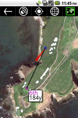
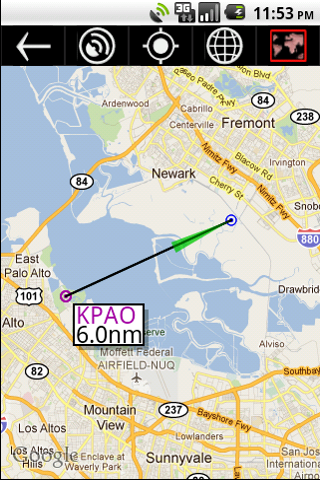
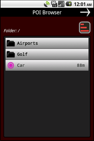
True Bearing is a simple app that displays orientation and distance from your current location to some point-of-interest (a runway, a dive spot, a geocache, the 9th green, etc) using Google maps and your mobile device's GPS & internal compass. A point-of-interest (POI) can be selected using the map, entered using latitude and longitude, set from your current location, or recalled from memory. The primary purpose of this project was to explore the practicality and limitation for using mobile devices to do accurate real-time heading and distance determination.
 or use this Android Market link
Possible uses include: aviation, diving, golf, hunting, and geocaching.
|
|
|
|
Download from the Android Marketplace
Project Tycho - Synthetic View Flight Display System
The Tycho SVFDS or "Synthetic View Flight Display System" is software designed to display a real-time computer generated 3-dimensional rendering of an aircraft's physical environment. In conjunction with
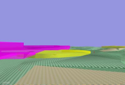 position and orientation information provided by GPS and AHRS (Attitude Heading Reference System) units, Tycho displays a computer generated synthetic view of the terrain, airspace, and obstacles that are out in front of the aircraft.
Screen shot from Tycho proof-of-concept
Tycho is primarily designed to help pilots avoid terrain, obstacles, and airspace incursion while flying visually: not under Air Traffic Controls guidance. It is also designed to help non-instrument rated pilots maintain control and avoid hazards in the case of an inadvertent visual flight into low visibility conditions - a situation that accounts for a large percentage of aviation accidents.
Tycho is in perpetual development.
Project dRAIS - digital Regional Aviation Information System
The dRAIS or "digital Regional Aviation Information System" is a system for digitally distributing regionally significant
information to aircrafts in flight. Utilizing terrestrial broadcast
facilities, the dRAIS system seeks to gather and distribute such
information as airport data (frequencies, TPA, runways in use, wind
direction, advisories/NOTEMs, sky conditions, METARs), weather data
(SIGMETs, AIRMETs, pilot reports), and general data such as NOTEMS and
TFRs. Once received, this information can then be displayed in the
cockpit using the Tycho system or an MFD (Multi-Function Display).
dRAIS is in the investigative stage.
